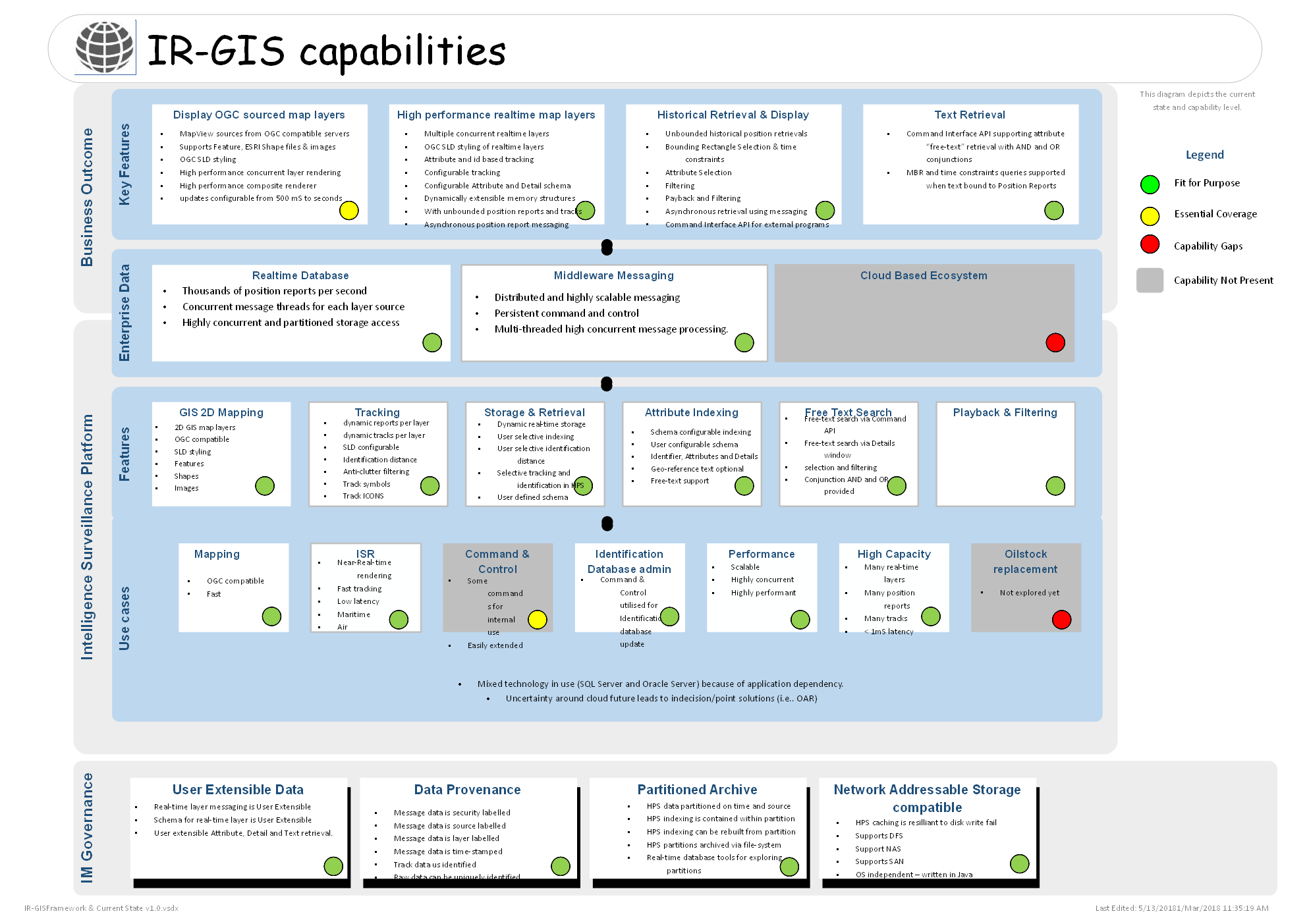
Capabilities
IR-GIS(R) has undergone a significant capability assessment

and we are now developing a new roadmap for:
- IR-GIS(R) MapWorld - a 3D GIS integrated with ir-xml real-time rendering, messaging the Historical Pullback Sever
- IR-GIS(R) MapProxy - a proxy GIS server
- IR-GIS(R) MapServer - a GIS server (for thin clients) integrated with ir-xml real-time messaging, renderering, and interaction with the Historical Pullback Server.
- IR-GIS(R) CloudStore - a cloud ecosystem real-time database - Historical Pullback Server
- IR-GIS(R) MapView rendering SLD style enhancements:
- head-mark direction and speed projection line SLD styling (a lead-arc useful for ATC and traffic)
- heat-map SLD styling of position reports and events
More development to be advised in due course.
references


