Technical Specifications
Technical Specifications for the original IR-GIS ® version 1.X are available in the media:product-sheet.pdf. Since the time of writing performance has been improved, and hardward has improved - so we haven't made too many measurements of late. Suffice to say, each layer can support thousands of position reports per second.
Updates will be provided in due course after we round-off the MapWorld development.
Recent performance improvements were made after version 1.0 and at version 1.3, and recently at version 2.0 there were storage optimisations.
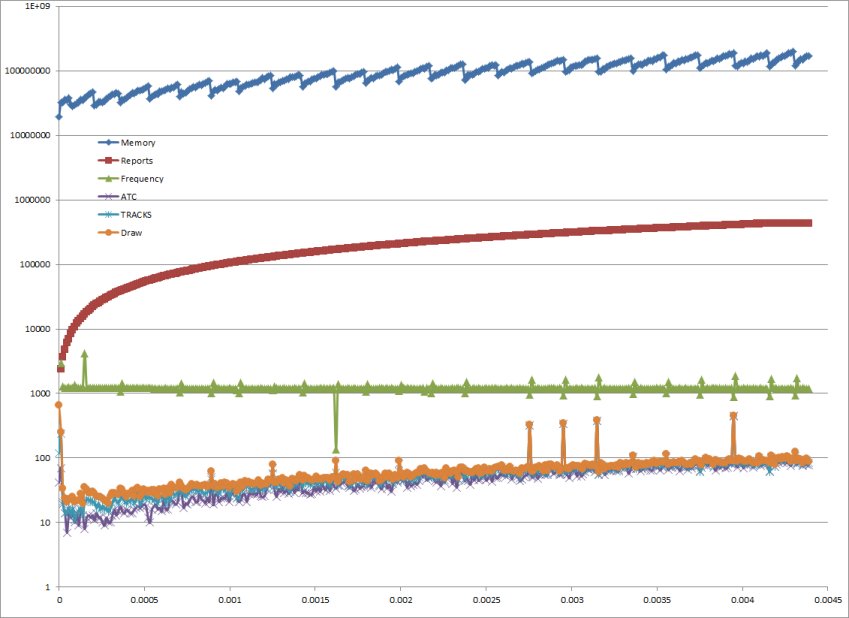
IR-GIS ® processes and archives input messages in real-time, both for display and historical archive and pull-back. We support the same speeds for archive and display - the design goal was 1200 Reports per second with an average of 96 bytes per real-time layer, with layers process and rendered in parallel, and our suite exceeds that goal by far.

The X-axis is the time in fractions of day,
Note the layers are Rendered in parallel.
Version 2.X is even faster, and since version 1.0 we switched to the 64bit address space - because our customer just kept processing more real-time data.
Semantically equivalent forms of messages are employed for archive and display, and our message attributes are characterised into:
- identifying attributes,
- amplifying details and,
- kinematic data
and represent quite compact formats that are user extensible. Any additional attributes supplied in the input message stream are automatically available in the viewer, and automatically presentable in the infoTool, without the need to code any changes.
All product will run without schema, however, when schema is provided it can override the classification of attributes to further optimise the storages. Attributes can even be black-listed so they are not used or recorded, providing further efficiencies if they are not needed in the clients.

Why would you use the IR-GIS ® product suite?
- IR-GIS ® HPS provides large-scale long-term data retention.
- IR-GIS ® MapView provides large-scale display of many position reports.
- IR-GIS ® MapWorld provides 3D steroscope VR display of real-time position reports, particularly interesting if airborne or over ruggered terrain
- IR-GIS ® Product is a mature and has been operational since 2010 providing Situational Awareness Displays with persistence across restart.
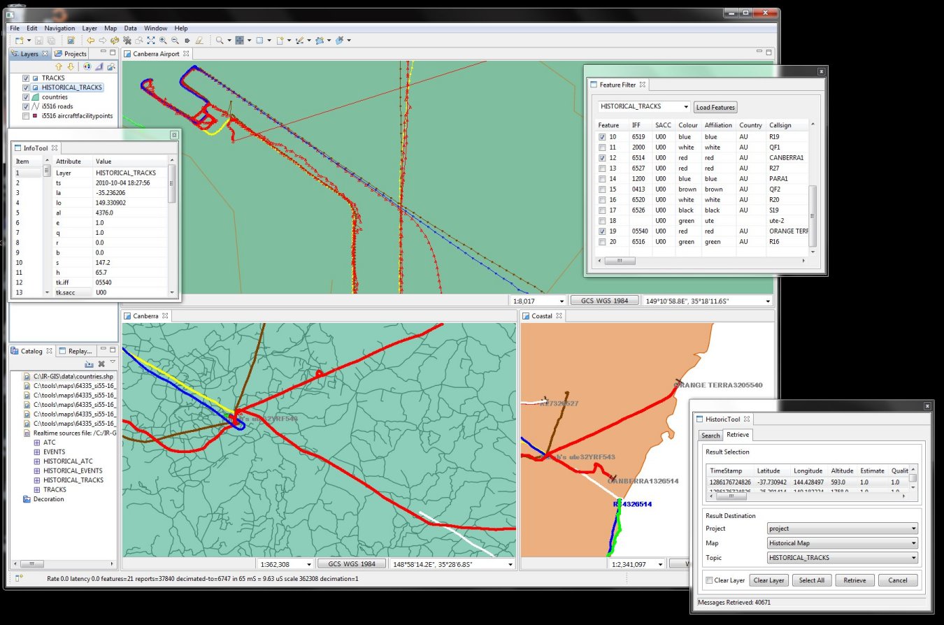
- IR-GIS ® MapView provides Historical Searches and the retrievals are displayed in layers on the maps in the areas of interest.
- IR-GIS ® Product suite persistence format is compact and long term, and user extensible and the HPS stores and partitions this data on a time basis for easy archive or disposal.
- IR-GIS ® HPS indexes in real-time and the proprietary search engine are highly concurrent making vast searches possible while displaying real-time data.
We will be progressively including more features in the product suite over time. We also believe that our system is the only GIS product capable of handling our real-time target through-puts.
Although the product line is general, it is also configurable, and can be tailored to each customer's mission - if and when desired.


